You are here
Back to topHampshire, Dorset & Wiltshire A-Z Visitors' Map (Paperback)
Email or call for price.
Out of Print
Description
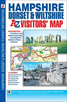
This A-Z Visitors' Map of Hampshire, Dorset and Wiltshire is a full colour, single sided sheet map. Featuring continuous road mapping from Oxford and Stroud to the south coast (including the Isle of Wight), and from Newport and Lyme Regis to Chichester and Maidenhead in the east.Map detail is shown at a clear 2.75 miles to 1 inch (1.7 kms to 1 cm) and includes the following features:•Motorways open with full junction detail, motorways under construction and proposed, service areas, primary routes and destinations, A and B roads, selected minor roads, gradients 1:5 and steeper, tolls, mileages, national and county boundaries, together with spot heights and hill shading.•Selected safety camera locations with speed limits.•Selected fuel stations.•Selected places of interest, tourist information centres, caravan and camping sites and golf courses.There are 2 separate index panels.•An index to cities, towns, villages, hamlets and locations is situated adjacent to the map.•A comprehensive places of interest index, with corresponding map symbol alongside each entry for easy identification, is situated below the mapping.
About the Author
Started in 1936 by Mrs Phyllis Pearsall MBE, Geographers' A-Z Map Company Ltd is the leading street map publisher in the UK, producing more than 200 paper mapping publications, including the much-loved London A-Z, Street Atlases, Visitors Guides, Great Britain Road Atlases, and a new range covering 30 of the country's most popular walking destinations – The Adventure Atlas.